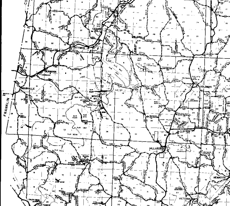
The map shows a great deal of overlap into townships T42N and T40N to the north and south, respectively.
The northern boundary of T41N is the horizontal that runs just south of Dittmer in the upper third of the immage. The southern boundary is the darker, solid horizontal line in the bottom third of the image that runs through Hillsboro (toward the right side of the map).
The western boundary of R2E (in Jefferson County) is the county boundary that runs at an angle by the word "Franklin" on the left side of the map. The boundary between R2E and R3E is the first solid vertical line from the right edge of the map (it passes through the "I" of "Grubville"). The boundary between R3E and R4E is vertical line just to the right of Morse Mill near the map's center; it's interrupted by a large eastward bend of Big River. The eastern boundary of R4E is the vertical line near the right edge of the map that passes through the "L" in "Goldman".