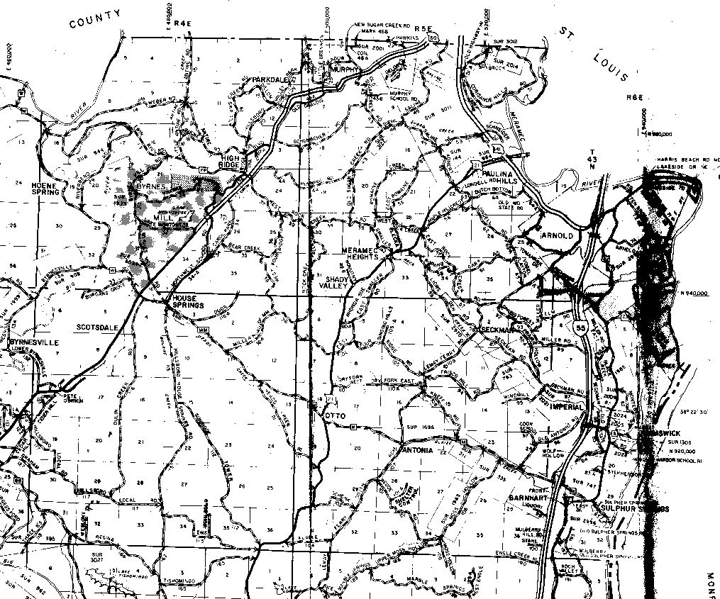
The northern boundary of T43N is the horizontal line at the top of the map in the middle, and the Meramec River in the northwest and northeast corners of R4E and R6E, respectively. The southern boundary of T42N is the first horizontal line up from the bottom of the map.
The western boundary of R4E is the vertical line that passes through the "O" and "P" of Hoene Spring, and the "S" of Byrnesville on the left side of the image. The Meramec River forms the eastern boundary of T43N,R6E and the northern part of the eastern boundary to T42N,R6E; the Mississippi River forms the southern part of the eastern boundary of T42N,R6E.
The boundary between R4E and R5E is the vertical line near the center of the image that runs the full height of the map (just to its right is a heavy smudged line that is the result of a crease in the scanned paper map).
The boundary between R5E and R6E is the vertical line that runs through the "M" in "Elm" (just west of the highway 55 "road sign" near the middle of the map on the right side).
The heavily smudged area on the right edge of the map is the result of a wide crease in the map I scanned. Unfortunately, I couldn't get a better image of this area.