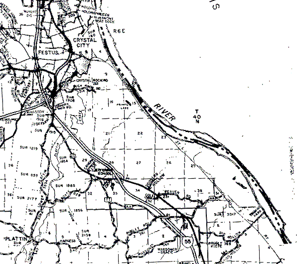
The boundaries of T40N,R6E are difficult to see, but many of the section numbers are clear, so it's fairly easy to work out where they should be. Section 36 has its northeast corner right on the Mississippi (or possibly out in its flood plain - that isn't clear from the map), toward the lower right corner of the map. The dark horizontal line at the bottom of section 36 is the township's southern boundary. If you follow the river upstream to the "R6E" on the map, the township's northern boundary should be just about there. The western boundary should be a (nonexistent) vertical line running just about due north from Plattin in the lower left corner of the map.
The offset and oddly shaped sections below T40N are the northern sections of T39N, and they are shown exactly as they were surveyed; their strangeness is not a result of the way the map was scanned and assembled.