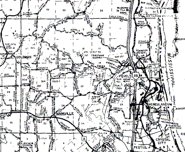
The northern boundary for both townships is the first dark, almost solid line near the top of the map (it crosses highway 55 just about where the map has "Engle Creek Rd" written on it). The western boundary of T41N,R5E is the dark vertical line through the "L" of "Godlman" near the map's left edge. The southern boundary of both is the first dark horizontal line from the bottom of the map. The boundary line between the townships isn't visible (T41N,R5E would be west of it, and T41N,R6E would be east of it). However, we can see section 1 of T41N,R5E - that little blob in the open area below "Engle Creek Rd" near the top right of the map is supposed to be a "1" - and going due south you can find the numbers for sections 12, 25, and 36. The boundary between the townships should run north-south just about through the point where a road meets highway 55 just east of the "12" in section 12. That means that T41N,R6E is roughly the area between highway 55 and the Mississippi River.