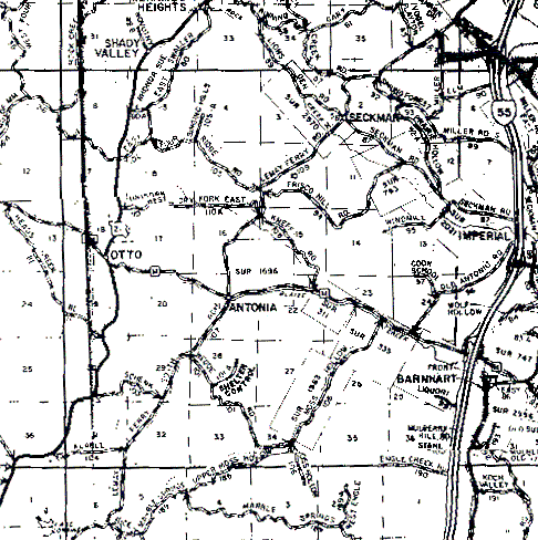
The northern, western and southern boundaries of T42N,R5E are the first dark, almost solid lines from their respective edges of the map. The eastern boundary is harder to find. If you look just to the right of the highway 55 "road sign", you will see the word "Elm"; the eastern boundary is the vertical line running through the "M".
The slight offset between the section lines of T42N and T41N below it (the sections at the very bottom of the map) is due to misalignment in the two images that were joined along the boundary between the townships. There should not really be any offset.