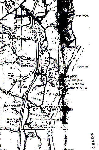
The western boundary of T42N, R6E is the vertical line that passes through the "M" of "Elm" toward the top middle of the map. The northern boundary is the horizontal line that crosses the vertical one just above "Elm". The southern boundary is the horizontal line just above "Koch Valley" near the bottom of the map. The eastern boundary is the Mississippi and Meramec rivers. The middle of the Mississippi is indicated by the heavy dashed line with thinner solid lines on each side of it. The Meramec is the wavy eastern edge of the big splotch on the upper right of the map.
My apologies for that big, ugly splotch. The scanner couldn't cope with a heavy wide crease in the map, and I couldn't find a way to make it come out any better.